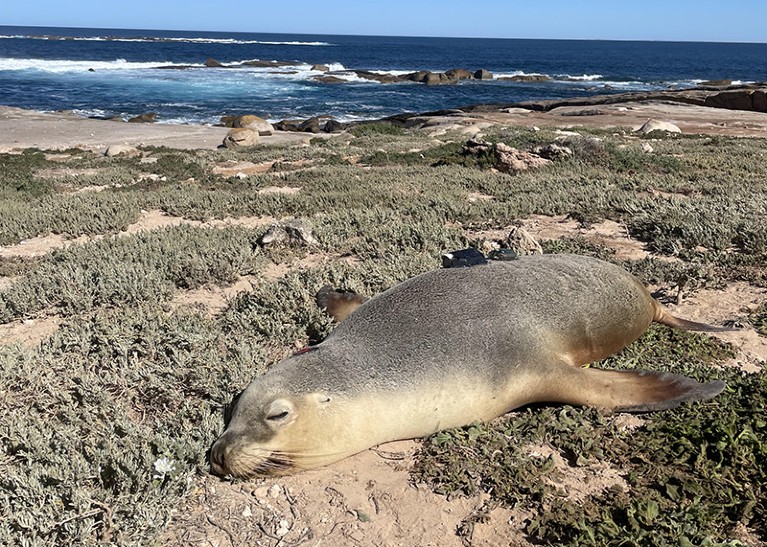
Scientists attached cameras and sensors to small pieces of neoprene that they glued to the sea lions’ backs.Credit: Nathan Angelakis
Footage captured by sea lions wearing lightweight video cameras is giving researchers a glimpse of previously unexplored areas of the sea floor off the south coast of Australia.
The findings, published on 7 August in Frontiers in Marine Science1, include detailed maps of the ocean floor created by combining videos captured by the animals with a machine-learning model. The camera footage also reveals details of how different habitats and species are distributed.
“These are particularly deep and remote offshore habitats that you can’t get to by usual surveys that you would conduct from a boat,” says co-author Nathan Angelakis, who researches ecology and evolutionary biology at the South Australian Research and Development Institute in West Beach. “With the data we’re collecting, we’re essentially exploring new parts of the ocean that haven’t been mapped”.
Uncharted waters
Table of Contents
Understanding the layout of the sea floor is important for several reasons, including marine conservation, navigation and predicting hazards such as tsunamis. “You can’t manage what you haven’t measured,” says Steve Hall, head of partnerships at the ocean-mapping organization Seabed2030, which is based in Liverpool, UK.

This AI learnt language by seeing the world through a baby’s eyes
Worldwide, just 26% of the sea bed has been mapped at high resolution. This is partly due to the challenges associated with exploring the deep sea, where pressure is extremely high and light levels are low. Researchers typically map the sea bed using remote-operated underwater vehicles or by dropping cameras from surface vessels — but both of these methods are time-consuming and costly.
Angelakis and his colleagues trialled a comparatively low-tech approach by enlisting the help of wild Australian sea lions (Neophoca cinerea). These animals spend most of their time on the sea bed, foraging for food across the continental shelf, the section of the ocean that extends from the coastline. The researchers theorized that by tracking the sea lions’ movements, they would be able to gather information about both the shape of the sea floor and the distribution of different habitats.
The authors attached sensors to neoprene patches that they glued to the backs of eight adult females from two of the largest Australian sea-lion colonies. The equipment, which included GPS trackers, cameras and motion sensors, was designed to be small and non-cumbersome, weighing less than 1% of the sea lions’ body weight, so as not to hinder the animals or affect their behaviour. On completion of the project, team members were able to remove the sensors from the patches without damaging the sea lions’ fur.
Together, the sea lions captured 89 hours of footage that took in six distinct sea-floor habitats, from bare sand to meadows of algae.
The researchers used the footage to assess biodiversity in these areas, and to compare the locations visited by the two colonies. They also used the videos to check the accuracy of a machine-learning model designed to predict the sea-floor habitat from variables such as sea-surface temperature and distance from the coast. This revealed that the model was more than 98% accurate, so the researchers then used it to map sea-floor habitats in surrounding locations. “One of the real powers of the study is taking the data we collected to predict other unknown areas,” says Angelakis.
The team also wants to use the sensor data to explore how factors such as depth and nutrient supply affect habitat distribution and biodiversity on the sea floor. This could help researchers to further explore “the ecological value of different habitats and marine areas to sea lions”, says Angelakis, which could boost conservation efforts.
Using sea-lion-mounted sensors is a “very nice way of getting high-resolution data from a hard-to-get-at place”, says Hall. He suggests that in future studies the researchers could equip the sea lions with extra sensors to gather data on the physical and chemical properties of sea-bed habitats.
